Featuring~Rhode Island e911 Exposure Assessment page
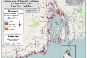
Take a look at the “e911” page, this page offers a summary of all exposed structures in each of the 21 coastal municipalities in Rhode Island within a variety of […]
» Read more
Take a look at the “e911” page, this page offers a summary of all exposed structures in each of the 21 coastal municipalities in Rhode Island within a variety of […]
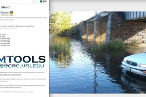
» Read moreThe article Tidal flooding in North Kingstown’s Wickford is result of rising seas looks at current flooding and inundation from high and king tides in Rhode Island and the implications […]
» Read more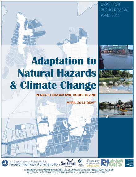
On Monday May 9th Teresa Crean presented the North Kingstown Sea Level Rise Adaptation Pilot Project to the North Kingstown’s Town Council. To watch Teresa Crean present of the NK […]
» Read more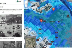
TOURING HISTORIC STORMS IN RHODE ISLAND: A Map Journal arcgis MapJournal webpage Click on the link above to view a “map journal” with maps, text, and photos to tour through […]
» Read moreThe RINPR article by Ambar Espinoza takes a look at the new FORTIFIED house being built in Matunuck, Rhode Island by Caldwell & Johnson. Pam Rubinoff of the Coastal Resource […]
» Read moreIn April 27, 1977 Jan Hutton interviewed Mrs. Nancy Allen Holst about the Hurricane of 1938. Holst was State District Forest Fire Warden for the Department of Agriculture and Conservation […]
» Read more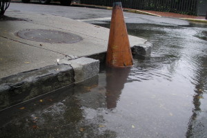
The Beach SAMP team has held multiple municipal work sessions in collaboration with other state agency partners to discuss adaptation planning at the local level. The purpose of these meetings […]
» Read moreShared on behalf of the Jamestown Press The article by Ken Shane reports on the recent showing of “Shored Up: When Human Nature and the Force of Nature Collide.” at […]
» Read moreThis video was produced by the Rhode Island Foundation and filmed by Connie Grosh, to document the Beach Profiling Workshop led by Jon Boothroyd and Bryan Oakley. They facilitated a […]
» Read more